Port Hills expansion for fire warning network
17 Feb 2025
Share this story
A fire protection network that helps detect the early signs of fire has expanded to four new sites in the Port Hills, all close to the Summit Road.
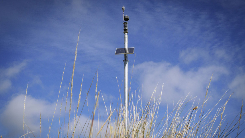
Christchurch City Council, in collaboration with Fire and Emergency New Zealand (FENZ) and technology partner Attentis has added four new self-powered sensors across the Port Hills.
They cover the areas of Worsley’s Road, Sign of the Kiwi, Sugarloaf and Bridle Path and are in addition to four existing sensors at the Christchurch Adventure Park. Other parts of the city with sensors are Naval Point in Lyttelton and Waitākiri Bottle Lake Forest Park. There are 15 sensors in total across the network.
Using smart technology, the sensors gather information on air pollution, smoke, wind speed and direction, along with visual and thermal imaging to help detect the early signs of fire.
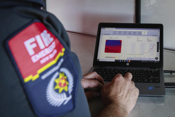
“These sensors provide instant notification to emergency services and Council staff, which will ultimately improve response efforts,” says Smart Christchurch Manager Michael Healy.
“Expanding the network on the Port Hills will increase the reach, vigilance and amount of data coming in which will help with mitigating risk through early detection and control.”
Mayor Phil Mauger says working collaboratively to build resilience is a key priority for the city.
“Past emergency events have provided us with opportunities to learn, to upgrade and to innovate, and this is another example of that process at work,” the Mayor says.
“By growing the fire detection network with the help of our partners, we’re helping to build safeguards to better protect our communities and the environment into the future.”
Community Risk Manager Fire and Emergency New Zealand Dean Harker, says the network is a "great tool in the toolbox", providing near real time information that helps to reduce the impact of fire on the community.
“During the 2024 Port Hills fire, the network provided key information that assisted firefighters both during the firefighting and mop up phases and as part of the investigation.
"Technology like this can be used to help us be an intelligence lead service and help prepare our community for emergencies," Mr Harker says.
Data captured in the network is freely available to the public and can be viewed online to help plan trips and inform every-day decisions.
Popular news