Step into the past with new walking guide
History & heritage |
26 Sep 2024
Share this story
A new self-guided walking map takes users through central Christchurch to discover life in the city during the late 1800s
The Ōtautahi Christchurch Central City Living History Walk helps people explore what life would have been like for the early settlers with a 2km fully pedestrianised tour around the central city. It focusses on the period when European settlers created the foundations of the city as we know it, changing the landscape forever.
We’ve pulled out six of our favourite stops to give you a taste of the tour.
Stop 2: Puāri Pā
Victoria Square was an important place for both Māori and Pākehā. Before European settlement, this area was known as Puāri Pā, with strong connections to mana whenua - Ngāi Tuāhuriri who are a hapū (sub-tribe) of Ngāi Tahu. It was used as a gathering point and trade centre for local Māori and was also a mahinga kai – a food and resource gathering area.
From 1850, with the arrival of the first settlers, part of the area became known as Market Square, and was considered the bustling centre of the growing city up until the Cathedral was constructed.
Stop 6: The Papanui Bridge
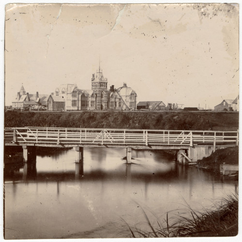
Provincial Council Buildings 1860 with Papanui Bridge in the foreground, CCL-StarP-01745A, The Christchurch Star Archive, Christchurch City Libraries
Bridges were vital for the early European settlers and this one, built in 1851, provided an important link to Papanui Bush, which supplied the majority of the firewood for the city.
In 1862 when a traffic count was undertaken, 1000 pedestrians, 58 bullocks, 316 horses and one donkey crossed in an eight hour period! Two years later it was replaced with New Zealand's first cast iron and stone cast bridge and renamed Victoria Bridge.
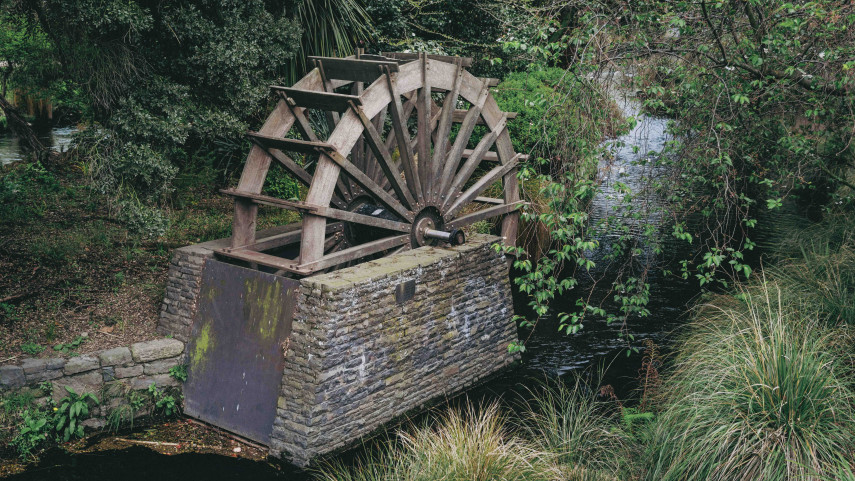
Stop 17: Mill Island
A chap called Daniel Inwood brought this island and in 1858 got permission from the Provincial Council to use the Ōtākaro Avon River for a flour mill for 30 years. He built a mill on the island Known as Inwoods Mill or City Mill.
When the 30 years came to an end, the mill closed and the machinery was removed but the building remained. Throughout the 1890s it was the Avon Refuge, a night shelter for homeless men. The replica wheel you see today was installed in 1997 by the Christchurch Beautifying Association, to celebrate their 100th anniversary.
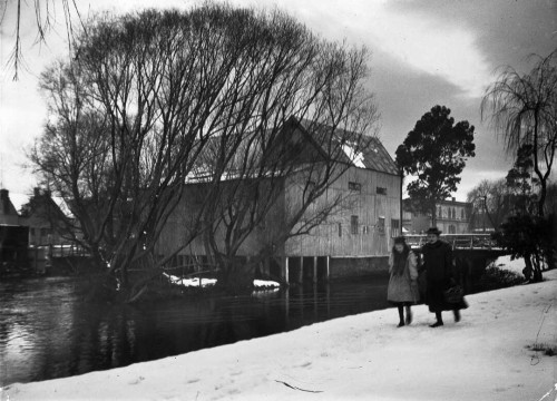
A view through trees of Inwood's flour mill building, Christchurch, 1/2-C-22845, Alexander Turnbull Library, Wellington, NZ
Stop 20: A city full of breweries
The area along Oxford Terrace known as ‘The Strip,’ has a storied past as a place to socialise and make merry.
In the early days this part of Christchurch was filled with breweries, hotels and stables. In 1866 there were 65 hotels in a city of 6500 - one hotel for every 100 citizens!
As many of the European settlers couldn’t swim and with the large number of hotels and lack of lighting, a total of 105 people drowned along this part of the river between 1850 and 1900.
Stop 22: Rhododendron Island
Public baths for bathing and swimming were built in the river downstream from Rhododendron Island back in 1877.
A deep channel was dredged between the island and the riverbank along Cambridge Terrace to create the baths. Rules included a one-hour stay and no dogs in the bath!
Take a walk!
Along with these six there are 28 more stops to be seen on the tour, so pop on some walking shoes, grab your phone or tablet and do some time travelling!
The tour starts outside Tūranga before heading to Victoria Square, then follows the Ōtākaro Avon River to Cashel Street. It then loops up High Street to Cathedral Square and finishes back at Tūranga, and will take you about one hour.
Find the Ōtautahi Christchurch Central City Living History Walk here.
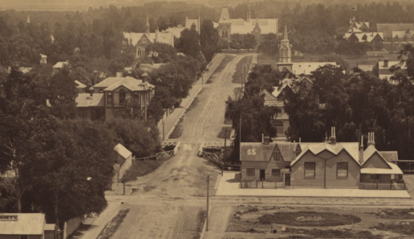
Worcester Street Bridge 1881, CCL-83446-008, Panorama of Christchurch from Cathedral Tower, Christchurch City Libraries
Popular news